Mt. Diablo State Park, located out past Walnut Creek, has over 150 miles of hiking trails and fire roads, and 56 campsites, all surrounding the massive mountain, which is elevation 3,849 feet.
As to be expected from a mountainous state park, there is lots to do here, the least of which is to see the view from the summit. The park brochure says that on clear days, like after a winter storm, you can see the Farallon Islands; southeast to the James Lick Observatory on Mount Hamilton at 4,213 feet elevation; south to Mount Loma Prieta in the Santa Cruz Mountains at 3,791 feet elevation; north to Mount Saint Helena in the Coast Range at 4,344 feet, and still farther north to Mount Lassen in the Cascades at 10,466 feet. With binoculars, you may even be able to pick out Half Dome in Yosemite National Park.
Mt. Diablo is another one of those parks, like Sunol, that is best hiked in the spring.
While the park has much to offer in the way of flora and fauna, I have to say that our walk was better because of the wildflowers, and that without them it would have been slightly less enjoyable. We went on Saturday, April 3, in keeping with my theory that it’s wise to do all the East Bay parks in the spring before a) it hots up so much that you have to wear protective burn firefighter suits just to get out of your car and B) to avoid unwanted critters like ticks, snakes, and tarantulas.
When we went, the wildflowers were still blooming, but probably on the downslope of their cycle. I’m sure this is because of our drought year that they are ending so early.
There are lots of trails to take all over Mt. Diablo. To be sure, it’s a fantastic park. But for kids, and my mother, the Mitchell Canyon-Globe Lily loop is perfect.
A few notes:
– The trail really doesn’t have any decent places to stop and have lunch, although it does have two benches marking the start and end of the Globe Lily Trail. The benches are small and out in the open, though, and better suited for a toes-up than a family lunch. However, there are picnic benches near the visitor’s center, so consider this when planning the walk.
– Make sure to bring a trail map. There are a few in the visitor’s center but honestly when I walked in there, I couldn’t find any free ones. Did I think to print one? Come on, of course not. That being said, the volunteers are incredibly knowledgeable and helpful and they will tell you where to go. Just make sure to have a trail map ahead of time.
– It’s also worth noting that trail markers for the Globe Lily Trail are nonexistent until you actually get to the start of it, which isn’t very helpful if you’re trying to find your way there in the first place. So do this: follow the Mitchell Canyon trail out until you see a bench. Pass that and then, at the second bench, turn right. Go up the incline to the trail marker. The trail is narrow and small, but this is where the real beauty of the walk is. That trail loops back to the first bench. In all, it’s about a 2 mile walk from the visitor’s center and back, which is very decent for the kids (the 4-year-old found it fine, as did my 66-year-old mother).
The visitor’s center, by the way, is a great place for kids to play with animal track-making, learn about the pine cones and trees, and study a gorgeous, full-color wildflower map. Definitely pop in there first.
The globe lilies were really cool and they were all over the place. The volunteer at the visitor’s center was very excited about them, as only a park volunteer can be, but it did rub off on us a bit, so spotting them was fun. They like shadier areas.
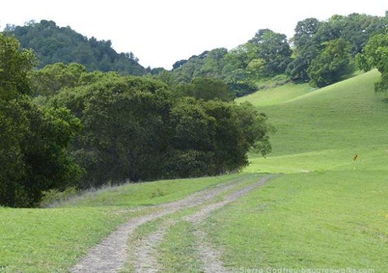
Most of the walk is along a nice, gravel road that is quite wide to allow for a variety of traffic–hikers, horses, and bikes. Keep on the right!
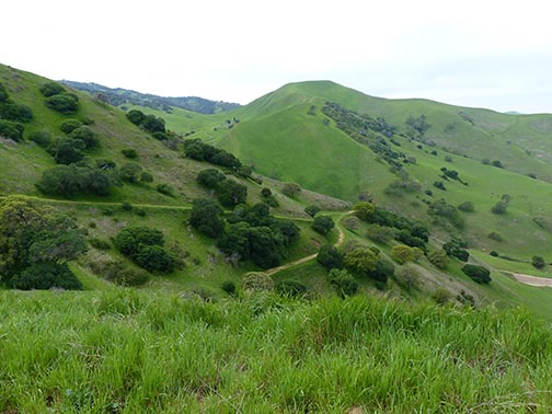
I like a nice gravel path, but honestly it gets a bit old after a while. Every nice park has a gravel path! Luckily, the Globe Lily Trail really gives you spectacular mountain views. It’s what makes this hike, honestly. Here it is:
I was particularly excited to see this butterfly and my poor husband spent quite a bit of time running after ones I pointed at and waiting for them to land so he could take a picture:
This is lupine– a common, but still pretty flower.
Animals Sighted
- Lizard
- Pale Swallowtail butterfly
- Painted Lady butterfly
- Lorquin’s Admiral butterfly
- Northern Checkerspot butterfly
- Chalcedon Checkerspot butterfly
- Assorted hawks and turkey vultures in flight
Information
- Mt. Diablo State Park website
- Park brochure with the all-important map (PDF)
How to Get There
- From Highway 24 eastbound or 680, take the Ygnacio Valley Road exit. Go about 7 miles, just as you’re about to despair of ever finding the place because you’re so far out into the sticks, and turn right on Clayton Road, and then right again on Mitchell Canyon Road.
- There is a fee to park.
- The Mitchell Canyon – Globe Lily Trail is about 2 miles roundtrip and very easy.


